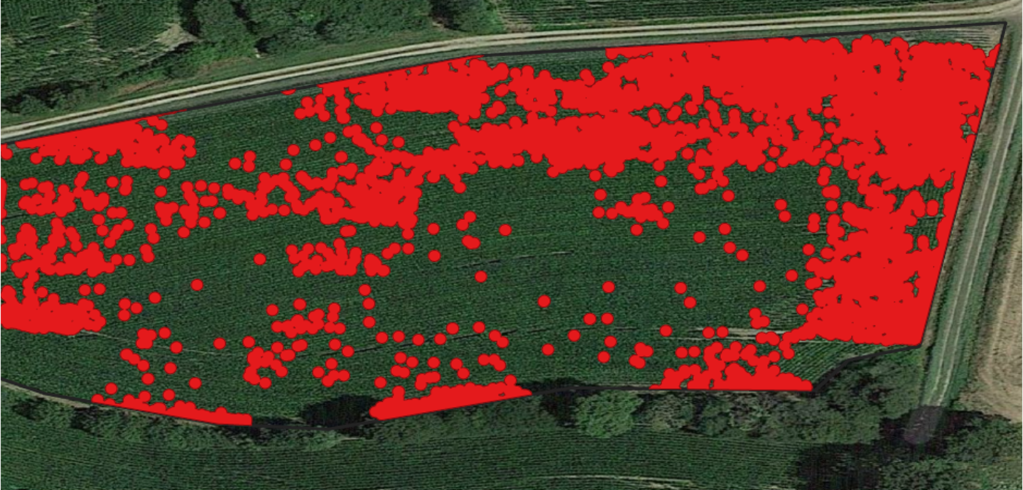
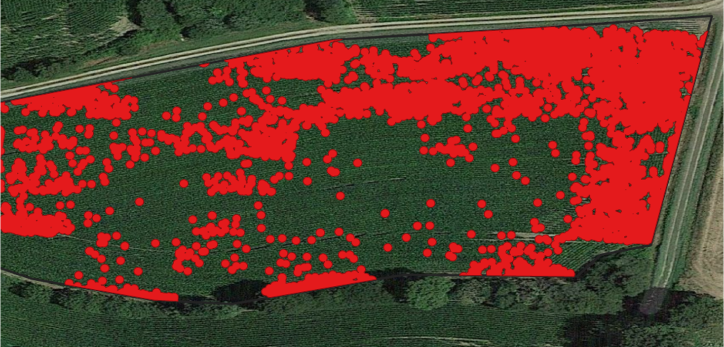


This service involves identifying and geolocating areas affected by weeds, using drones and Artificial Intelligence (all types of weeds, without classification), in order to restrict competition with field crops and spring vegetable crops (competition for water, space, light and nutritional elements).
All areas covered by weeds are precisely located (isolated and/or grouped areas) in order to determine their weed cover at the young crop stage or at the latest before the inter-rows are closed.
The detection maps obtained within 24 hours can be directly incorporated into spraying equipment for localized application of weed killer, to avoid yield losses while at the same time reducing the surface area requiring intensive treatment.
That means farmers can apply suitable corrective measures for the specific needs of their plot.